Leaders in Graduate Education
THIS GUIDE IS NO LONGER ACTIVE. For the current FP Guide, click here.
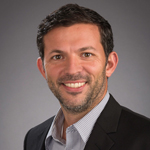
Gordon McCord, Assistant Teaching Professor
UC San Diego School of Global Policy and Strategy
Seven years ago, Gordon McCord, assistant teaching professor of economics at UC San Diego’s School of Global Policy and Strategy (GPS), designed a new graduate course focusing on geographic information systems (GIS). “GIS and Spatial Data Analysis” is now the school’s most popular elective. It emphasizes geography as an important lens through which to study society.
“All sorts of social processes happen in space, from the spatial dynamics of how humans relate to each other to the diffusion of information such as new farming practices,” says McCord.
“We offer our students the chance to gain a sophisticated understanding of GIS tools. It puts their résumés on employers’ short lists very quickly.” –Gordon McCord, Assistant Teaching Professor, UC San Diego School of Global Policy and Strategy
GIS is a suite of geography-based tools for gathering, managing, and analyzing data. It uses spatial location for data analysis to reveal patterns, relationships, and situations. GIS is particularly useful for analyzing the environmental impacts of human society and for investigating the special dynamics of relationships between people.
 In a 2015 study, for example, McCord used GIS to help show how climate change might affect the geographic extent of malaria transmission across the tropics. More recently, he was part of a research team that used GIS to map out the locations where people were killed in Northern Ireland to help determine whether homicide was more likely in mixed neighborhoods of Catholics and Protestants than in more homogenous areas. In another study, a GPS student used GIS to track economic activity in North Korea by mapping images of nighttime light emissions in different parts of the country.
“Some schools offer a generic GIS course, but at GPS, we offer our students the chance to gain a sophisticated understanding of GIS tools,” says McCord. “It puts their résumés on employers’ short lists very quickly.”
 The GPS course takes a novel approach. “We make a beeline for what political scientists, economists, and other social scientists and policymakers actually do with GIS,” says McCord.
That approach complements the school’s emphasis on rigorous, data-driven analytic training based in economics, advanced statistics, and related fields. GPS students acquire a systematic approach to program design and evaluation, whether their interests focus on advancing human rights, promoting sustainable energy use, or other endeavors.
During the first year of the school’s two-year master’s degree programs, students take a range of required courses, including courses in quantitative methods. “GIS and Spatial Data Analysis” is offered as a second-year elective.
The school also offers an advanced GIS course that covers remote sensing and analysis of satellite imagery. Additional GIS courses are planned for spring 2019. Master’s degree students at GPS will be able to earn a Certificate in Spatial Analysis after completing a three-course sequence.
“In public policy and international affairs, most problems you want to think about are spatial in nature,” says McCord.
Alumni currently using GIS skills they learned at GPS are employed at the World Bank and other multilateral institutions, government agencies such as USAID, private companies, and think tanks.
 The GPS Master of International Affairs (MIA) program teaches a broad set of analytical skills, with a regional focus on Asia and the Americas. In the Master of Public Policy (MPP) program, students may concentrate on one or more policy areas, such as environmental issues, business, health, or security. In 2017, GPS launched its Master of Chinese Economic and Political Affairs (MCEPA) program. Mid-career professionals may pursue the one-year (or part-time, two-year) Master of Advanced Studies in International Affairs (MAS-IA).
Graduate Degree Program Options:
- Master of International Affairs
- Master of Public Policy
- Master of Chinese Economic and Political Affairs
- Master of Advanced Studies in International Affairs (executive degree)
- PhD in Political Science and International Affairs (with UCSD Department of Political Science)
Visit the Request Info page to receive more information.
Contents
- Leaders in Graduate Education
- Thunderbird School of Global Management, Arizona State University
- Johns Hopkins University, School of Advanced International Studies (SAIS)
- University of Denver, Josef Korbel School of International Studies
- Duke University, Sanford School of Public Policy
- University of Washington, Henry M. Jackson School of International Studies
- UC San Diego School of Global Policy and Strategy (GPS)
- University of Kent, Brussels School of International Studies (BSIS)
- George Mason University, Schar School of Policy and Government
- Indiana University, Hamilton Lugar School of Global and International Studies
- Columbia University, School of International and Public Affairs (SIPA)